|
As for the Pitcairn Island group, the first island we met travelling from the
east was Ducie. It is an uninhabited island as are Henderson and Oeno. From our
ship we would typically descend a gangway to board a Zodiac that was capable of
holding 10-12 passengers. Landing on these islands required motoring the Zodiacs
through breaks in the surrounding coral reefs. In these cases we'd land in the
morning and return toward noon or mid afternoon. Tide changes often left us
toward low tide that would make for some serious planning to traverse the breaks
in the reef without bottoming out. The Zodiacs did a great job of avoiding the
coral, but during the trip some of our fellow passengers and support staff wore
bandages and acquired scabs from personal meetings with the coral. 
Landing on outside of the 'C' shaped island Ducie made for a wonderful day. The seas cooperated and gave us a great day
for landing. Our expedition leader was known by many of the passengers from past
trips and historically he seemed to have amazing connections with a greater
power to obtain good weather when needed. High winds translate to rough seas and
the resulting swells make getting from a gangway landing to a Zodiac not just a
challenge, but a potentially dangerous experience. You'd think if the weather
were bad you might have the option of just waiting for good weather, but having
a schedule means you have to move on or sacrifice something else along the way
if you choose to wait. Ducie is an atoll and is shaped like a 'C'. We landed on the outside of the
'C' shape and on the left center as written. On the inside of the 'C' shaped
atoll is a lagoon. We did get to eat lunch on the island and even snorkel in the
lagoon. The birds we saw included the Masked Booby, the Murphy's Petrel, the
common Fairy Tern, and the Great Frigate Bird. 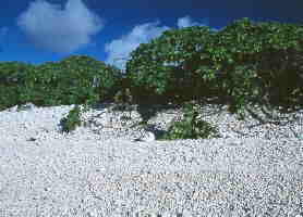
Boobies tend to reside near the edge of vegetation, ocean is behind
camera. The lagoon had wonderful colours. On the outside of the island there is
constant abrasion from the surf so the coral beach is very white. On the inside
near the lagoon the coral beach is extremely gray from a blue-gray algae that
has the opportunity to cover the coral because this area is protected in large
part from the surf. 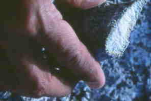
The lagoon side of the island's beach is also coral covered, but is gray due
to blue/gray algae. If one snaps a piece of coral one sees the white coral
colour at some depth. If one digs down about 6-8 inches one will also find white
coral. The island is rarely visited. Any floating trash that is in the ocean travels
until it finds a piece of land it can rest on. This is the only island for a
very large stretch of the planet. The island has an incredible amount of
plastic, fish line, and glass that is washed ashore. There are lots of buoys and
floats probably from fishing nets. Our group spent a good bit of time cleaning
up and bagging some trash that at the end of the day was hauled back to the
ship. The poor Russian that was in charge of sorting trash between items that
could be incinerated and those that would be carried to an appropriate landfill
wasn't too happy, but we think everyone else found it the proper thing to do.

Buoys were noticed in many locations on the island. We do not know if these
are really buoys or whether they are floats from fishing nets. 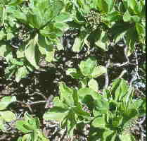
The island is in large part covered by Beach Heliotrope (Argusia argentea).
Walking inland from lagoon side of island. We found an opening in vegetation
and walked a ways inland. We noticed that trash was carried far from the shore.
This trash consisted mostly of buoys 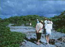
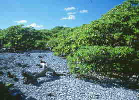
Path that crosses the island from outside of 'C' to the inside with the
lagoon. This should give you a good indicator of vegetation height.
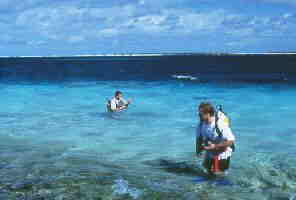
A couple of staff were in the lagoon with scuba gear from the ship.When we
visited Pitcairn these two guys actually visited the remains of the Bounty in
Bounty Bay Photos and text by John and
Jean Frazier (From Mark Winthrop of Copenhagen, Denmark. Used by permission. (http://www.winthrop.dk/ducie.html)[Islands of the Pitcairn Group] [Ducie Island] |